
Color Scan – a perfect adjunct to PLAYER
 Do you want to covert map images to GIS features? Well Color Scan can!
Color Scan (a product by Spatial Monkey) is an extension for ArcGIS that works with map images to:
-
- Extract lines and polygon features;
- Attribute lines and polygons by color;
- Save vector features as a Shapefile or
- to a Geodatabase; and/or
- Interpret color scale maps, such as depth maps, and save these as a raster grid GeoTIFF’s or to a Geodatabase.
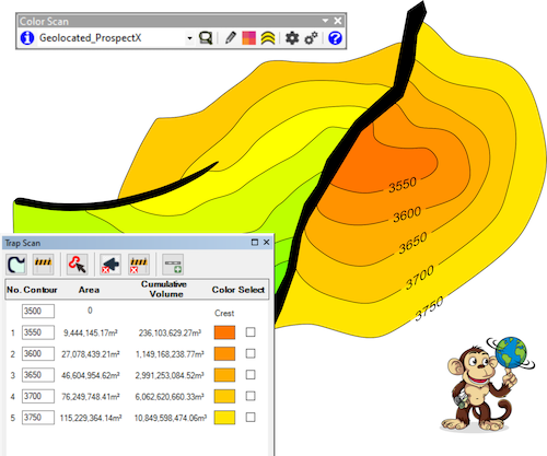
Color Scan also features Trap Scan, which extracts depth/area pairs from prospect and leads maps, such that these values can be loaded into QwikEval in Player.